You Yangs Walk

The weather was partly cloudy and the temperature was around the twenties. It was near perfect condition for a walk in the You Yangs. We met up with a couple of families (one of which is visiting from Hong Kong for a lunch picnic near the tunrtable car park.

We had original planned to make the climb up to Flinders Peak but the track was closed for repairs. Instead, we deciding to walk to Bunjiil Geoglyph which is a much easier walk. It was spring and the flowers were in full bloom. That makes the walk quite pleasant.

When we reached the Bunjiil Geoglyph, there we 2 geocaches that we could find. One was Apollo 11 and the other was Where Australian Eagles DareApollo 11 is a multicache which requires you to get to Flinders Peak for clues to solve a puzzle. Fortunately, we solved the puzzle from our last visit to the You Yangs.

The two caches were relatively quickly found. We looked around a bit before heading back to the Turntable car park. Before we left the You Yangs, we visited Big Rock which is quite impressive.

Overall, it was a lovely day out for all of us.

Brunswick to Reservoir circuit

It was the Victorian Labour Day long weekend. We decided to take the bike out for a spin. We decided to follow the bike path on St Georges Road and find out where it leads to.

St Georges Road Bike Path

The St Georges Road Bike Path is rather unique in the sense that it is build between 2 roads. The tram track also runs along either side of the bike path. Trees on side of the path provide ample shade and it has an excellent surface to ride on. The only downside of this path is that it is not a dedicted bike path but a shared path for bikes and pedestrain.

We had wanted to find out where this path leads to for some time now. The Labour Day holiday was an excellent opportunity to do this.

The weather was low to mid-twenties and sunny. A near perfect day for cycling.

We set out from home and cycled on quiet Stewart Street toward St Georges Road. Stewart Street cross a few major roads including Lygon Street. Fortunately, there is always traffic lights nearly to cross the busy roads. We linked up to Authurton Road where there is no bike paths. The kids rode on the footpath toward St Georges Road.

Ray Braham Gardens
Ray Braham Gardens

When we reached St Georges Road, we headed north. This took us pass two geocaches which we stopped. The first one was the The Phantoms Skull Cave which we found fairly quickly after looking at the hint.

The second one was End of the line for Ray which in the Ray Braham Gardens. It took us some time but it was still a pleasant find. We took a rest before continuing our journey northwards.

When we reached the Murray Road junction, the bike path continue towards Reservior. We took that path as we were curious to seek if it lead somewhere interesting.

It took us to G.E. Robinson Park where we found another geocachine: Anyone for Tennis? (2). The locate cache fairly easily. Looking around the path northwards does not look very inviting. We decided to backtrack to Regent Street and find a way to the Upfield Bikeway. We eventually ended up on Murray Road and cycled on the shared path next to the Road. This takes us to the Upfield Bikeway/Gaffney Street intersection. We then head south along the Upfield Bikeway towards home.

Brunswick to Flemington return

Today we cycled with another family from Brunswick to Flemington and back. The weather forecast was “mostly dry” but the sky looks threatening. We decided to take a chance and go out anyway.

We took the usual route to Dockland using the Upfield Bikeway which connects to the Capital City Trail around Princes Park. The journey was fairly uneventful but at the back of my mind I do wonder if we are going to make it. We have been been doing much cycling lately.

We stop at Dockland briefly for lunch. We bought ourselves a cheap lunch at Costco and took the bike path along Footscray Road toward Maribyrnong River. We cycled upstream on the easten bank. This is also where Flemington Race Course is. We observed the activities around the race course but wasn’t able to catch a glimse of the action on the track.

On the way back, we crossed the bridge to the western bank. As we passed by a buddist temple in construction, I spotted a Geocache nearby on the GPS received mounted on my handle bar. It didn’t take us long to locate the hide. We did even need to read the description. After signing the log and took some pictures, we continous downstream toward Footscray Road.

From Footscray Road, we headed east toward the Moonee Ponds Creek/Capital City Trail. We continue on to the Upfield Bikeway home at Princes Park.

It was about 28km of cycling today. The weather held up but was drizzling a bit when we got home. It was a cool day: around 18C. A bit cooler than ideal for a bike ride but we nevertheless had a good day.

Return Trip to Docklands

The weather forecast for the day was excellent. Although afternoon cloud was in the forecast, there was enough sunny breaks to make it one of the best winter days in a long while.

We cycled down the Upfield Bikeway at about 3pm. That meets up with the Capital City Trail. We went past the Zoo until Flamington Bridge station where the trail joins Moonee Ponds Creek. From the Zoo to this point, it was mostly downhill which makes it easy. The hard part is in the return journey.

Moonee Creek takes us to Footscray Road. The bike path along Footscray Road takes up to Shopping Town in Docklands. We pushed our bikes to the waterfront where we stopped for some ice-cream and snacks to replenish our energy for the journey home.

While riding back to home, we realised that we were going past a recently placed geocache. We decided to attempt this cache since it was only a few metres from the Footscray Road bike path. It was a relative easy find although the GPS coords was a bit off.

Whilst the journey to Docklands was mostly downhill, the journey back require us to climb a few hills between Flemington Bridge Station and the Zoo. It wasn’t a difficult climb but we wished that the climb was in the first half of the trip rather than the second half.

We reached home at about 5pm – a 2 hour trip. The total distance travelled was about 16 km. Overall, a really pleasant bike ride on a lovely winter afternoon.

Brunswick to Docklands Return

We decided to cycle to Docklands for ice-cream that afternoon. We had not been on our bikes for the last school term so it would have been a nice ride with a good distance. It would also be the first time the rest of the family would have cycled on the relatively new Manningham Street Bridge.

The weather was cloudy with the occassional sunshine which is good cycling weather. We left the house at around 2:30pm. The temperature was around 20C. Since it has been a while since we were on our bikes, we decided to take it easy and ride slowly.

It took us about 50 minutes to reach Docklands. We went to the ice-cream store at the waterfront. The kids had ice-cream on cones while the adults had ice-coffee with ice-cream. Yum!

We cycled to central to look for the cache Sea Dog Tales. There wasn’tmany people around which made the hunt quite easy and uninterrupted. The coordinates was excellent and the cache was soon found.

We headed off to the Bike Force cycling shop in Harbourtown but did find anything we want to purchase. We did some shopping at Costco before heading home.

The journey was about 18km which is a good introductory ride. From Brunswick to Docklands, the trip was mostly downhill. On the way back to Brunswick, there is a relatively gentle but sustained climb from Flemington Bridge Station to Parkville. We reach home before 6pm. It was a good afternoon of cycling.

Buttongrass Nature Walk

The weather forecast for the day was 23C and isolated showers in the morning. As we drove to Bunyip State Park, it started to rain. Fortunately, when we arrived at the car park of the Buttongrass Nature Walk, the rain abated and the sun revealed itself.

The road from Gembrook to Mortimer Picnic Ground appears to have been recently sealed. The brochure of the Park from Parks Victoria indicated that it would be an unsealed road. The sealed road makes the drive (for a 2WD vehicle) easier.

Although a portion of the road is unsealed, the drive wasn’t too bad. The condition of the road is very good compared to some we have travelled on. When we reached the car park, there were at least 4 vehicles already parked. We thought that we might have some company along the walk. However, we did not see anyone else along the way.

From the car park there is a short walk of about 200 metres leading to the start of the walk. The waypoint for the geocache Grass Buttons # 1 is an information board for the walk. The final location of the cache was worked out from the information on the board and we were quickly on our way.

The walk to the final location of the cache was fairly long. The surrounds was typical of the Australian bush. The hide was fairly obvious to a geocacher. We were the first to find (FTF) this cache and there was a prize waiting for us! This was our first FTF after caching for one and a half year.

The kids also fancied a Geocaching Badge in the cache. We took a badge and left a Zebra, Camel and safety pin in exchange for the badge. We signed the log and continued our journey.

In this leg of the walk, we noticed that bush fire had recently ravaged this section of the park. This might have been the fires that occurred in February of 2009 (last year). It is also heartening to see that the recovery is very much on its way.

Our next stop was for the Geocache Grass Buttons # 2. While the previous geocache was a multicache, this one was a traditional cache. The cache was located quickly. Again we claimed the FTF prize and left a dog and an elephant in the cache. At this point, it started to drizzle lightly for a short while but it did not pour. We were still very comfortable continuing the walk.

Continuing our walk, we saw lots of Button-grass on both side of the track. It is quite a sight to behold. The next Geocache from the last one was only a short distance away. Grass Buttons # 3 was a bit more challenging then the other 2. It was difficult, if not impossible, to locate it by sight. We manage to get to it by touch with some degree of stretching. Again we collected the FTF prize and left a lion and a ram in the cache.

After rehiding the geocache, we make tracks back to the car. On the way, we saw mushrooms growing in the wild. Throughout the walk, wild flowers and butterflies can be seen everywhere. We wonder what this park will look like in spring. We suspect that it would be a very different experience in different seasons. We will need to make more trips to find out for ourselves.

We had a very different geocaching experience today. After a year and a half of geocaching, we had finally got our first FTF. To top that, we had 3 FTFs on the same day! The prizes were an added bonous. Many thanks to hi pressure for providing us with such a wonderful experience.

hi pressure

Of giants and trees

Some showers was in the forecast but the morning was only partly cloudy with moderate winds. It was inviting temperate for a bike ride and cache hunt. 2 new geocaches poped up nearby in the last few days, so we were eager to get on our bikes to hunt for them.

We travelled southwards on the upfield bikeway to Royal Park. We followed the path around the zoo towards Elliott Avenue but crossed the trams tracks to the car park of the State Netball and Hockey Centre. We took Brens Drive and that got us to the park where the Geocache Giant’s Lunchbox was.

The find was relatively quick. The container is a Chinese Moon Cake container. It brought us memories of last year’s Moon Cake Festival. We did not make any swaps. After signing the log box, we returned the container to the hide and head off to the next Geocache.

We continued on Brens Drive until it reaches Elliott Avenue and followed the bike path along this road for a few meters before crossing the road into park lands. Having mountain bikes gave us the advantage of being able to ride to the Geocache Girl in a Tree. This cache is fairly exposed and precariously perched. I had to execute an upward maneuver to get to it. The container was also a small Moon Cake case. We signed the log book and left.

From this location we cycled to the path on the boundary of the zoo to get us back to the Upfield Bikeway to go home.

An hour after the ride, it started pouring. We were glad that we took this ride in the morning while the weather was still good. It wasn’t a particularly long ride by any standards. It was only about 9km but is was very enjoyable. That’s what counts most.

http://www.geocaching.com/seek/cache_details.aspx?guid=7a784111-3876-4480-a708-3f0b4e21831f

Geocache hunt: …Springs Eternal

We took this walk to hunt for the geocache …Springs Eternal. It was quite a lovely day for a walk. The total distance walked was about 2.4km. In one section of the walk, we turned into the wrong track and had to back-tracked a bit. It added about 50m to the walk.

When we approached the Geocache hide, we had to leave the track. The coordinates was about 10m off. We still managed to locate the cache by virtue of reading the description carefully. That helped narrowed the search somewhat.

The cache container was a lot larger than average. We did not do any swaps. That ended the last activity for the day on a high note.

Southbank to Williamstown

We planned this cycling trip with some family friends. The plan was to ride from Southbank to Williamstown by crossing the Yarra River with the Westgate Punt. We took the train to Flinders Street station. As it was a Sunday, the Sunday Saver ticket came in handy. The Sunday Saver allowed the holder to travel on all public transport on both zones.

While waiting for our friends to join us, we decided to hunt for a Geocache at Southbank. It was still early in the morning, so there wasn’t much human traffic about. This made it easier to locate the Geocache. If you are a Geocacher in Melbourne, I highly recommend this cache.

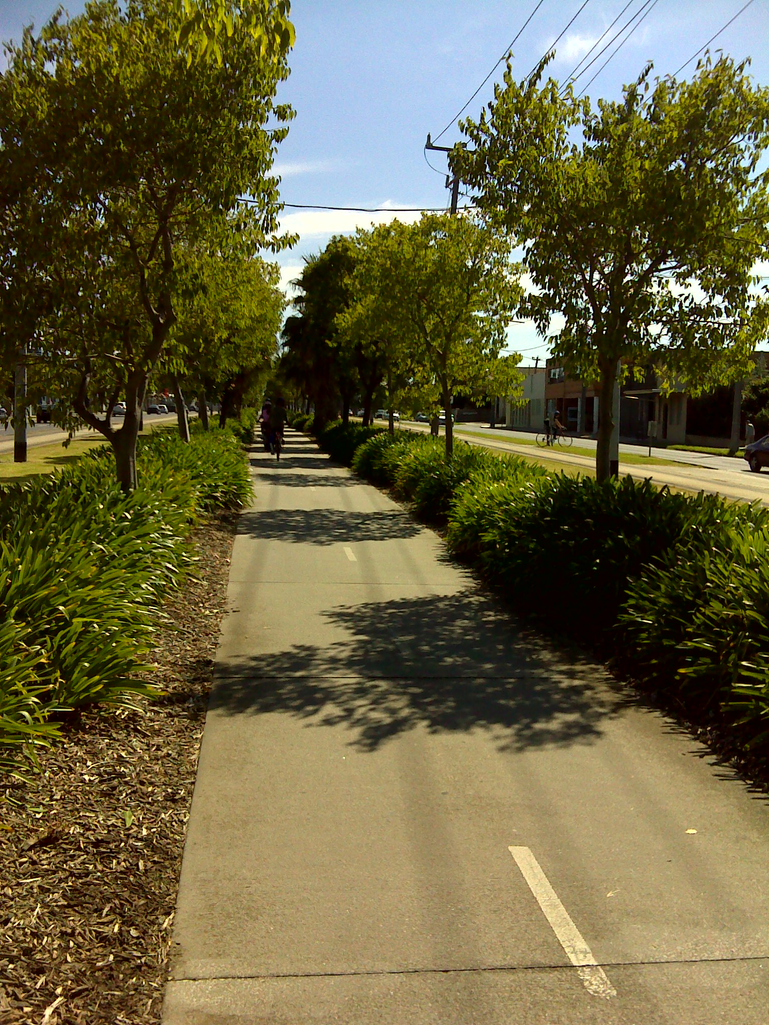
When our friends arrived, we cycle along Southbank to the Melbourne Exhibition Centre. By this time, there were more people about. From the Melbourne Exhibition Centre, we cycled to Normanby Road and followed the tram tracks. The tram tracks took us through a tram yard and through several parks in Port  Melbourne. We rested at one of the playgrounds that dotted the parkland. The kids enjoyed themselves at the swings.

When we reach the Ferry Terminal, the Spirit of Tasmania wasn’t moored. We debated whether we should have something to eat at the nearby cafe or proceed to Westgate Park to take the Punt across the Yarra to Spotswood. As it was only 11am, we decided to press on.

Along the way to Westgate Park, we hunted for the second Geocache of the day. We found the predecessor to this cache not long ago nearby. The old cache has now been disabled. The hide for this cache is very innovative. We would not have guessed the hide if not for the hint left by the owner. Another cache I would consider a must-find.

As we approached Westgate Park, we found that the route to the Punt did not go through the park anymore. There is a cache in the park I would like to find, however, the others had cycled ahead. I decided against calling them back as I did not wish to break the momentum the kids had going then.

When we reached Lorimer Street, we weren’t quite sure whether to turn left or right to the Punt terminal. There weren’t any signs to guide us. We decided to ask for directions. Fortunately, one of the two men nearby knew the way and got us promptly towards the Punt Terminal.

After a short wait the Punt arrived. Our friends’ kids had never been on the Punt so it was a refreshing experience for them. Although we had been on the Punt in the past, it was still a highlight of the cycling trip that we always looked forward to.

After crossing the Yarra, we had to make a decision whether to visit the ScienceWorks Museum. Although one of our kids was willing, we felt that it was close to lunch time and the food at the cafe in ScienceWorks wasn’t particularly inspiring. So off to Williamstown centre we went.

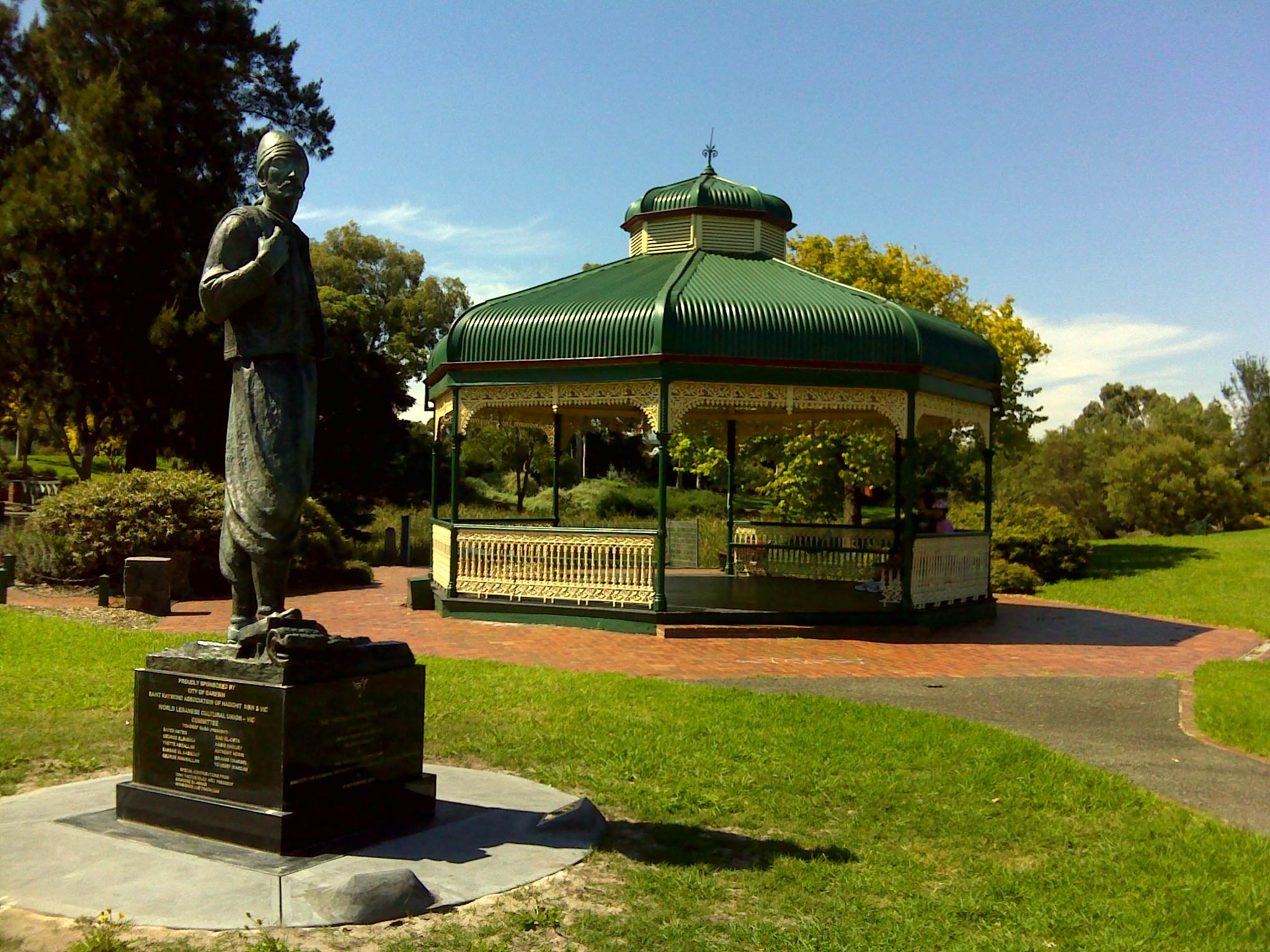
We purchased some take-away and ate them at the park in Williamstown Centre. After which the kids played in the nearby playground. We spent some time at the park before going to the nearby shop for some ice-cream.

We continue to cycle along the shoreline of Williamstown. That’s when we had our third Geocache hunt. It was a relatively easy find. There was another nearby cache I would have liked to attempt but the others had already cycled on.

After reaching the Esplanade, we backtracked a bit to Thompson Road and head for Williamstown Station. This completed the cycling trip.

When we left home, the temperature was in the high teens. At the end of the ride, it was probably in the mid-twenties. It was mostly sunny and got a bit windy at the end of the ride. Oeverall, it was excellent cycling conditions. The ride was over 17km which is a great achievement for the young ones. This route is one of the most scenic Melbourne has to offer. I highly recommend it.